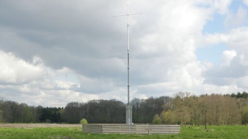
There’s an already-extant ground-based vessel navigation system, Loran-C, though I’m sure that it’s possible to improve on it and I have no idea how much of the receiver hardware is still out there.
https://en.wikipedia.org/wiki/Loran-C
The introduction of civilian satellite navigation in the 1990s led to a rapid drop-off in Loran-C use. Discussions about the future of Loran-C began in the 1990s; several turn-off dates were announced and then cancelled. In 2010, the US and Canadian systems were shut down, along with Loran-C/CHAYKA stations that were shared with Russia.[2][3] Several other chains remained active; some were upgraded for continued use. At the end of 2015, navigation chains in most of Europe were turned off.[4] In December 2015 in the United States, there was also renewed discussion of funding an eLoran system,[5] and NIST offered to fund development of a microchip-sized eLoran receiver for distribution of timing signals.[6]
The National Timing Resilience and Security Act of 2017, proposed resurrecting Loran as a backup for the United States in case of a GPS outage caused by space weather or attack.[7][8]
And what is Galileo supposed to be then?
It’s the same as GPS (American) or Glonass (Russian). Satellite based positioning, which is vulnerable to jamming. It could also be turned off, just like the others, hence the need for an alternative.
which is vulnerable to jamming
This has, in fact, been a serious problem in the Baltic region, as Russia’s military has been jamming GPS there for some time, and it dicks up navigation for ships and aircraft there.
Is this new system, R-Mode, invulnerable to jamming? It uses radio spectrum, so I’d think not, but it’s not mentioned in the article.
I’m sure not, but even without looking at any technical details, it will have at least a couple benefits:
-
First, it’s short range. GPS satellites are in geosynchronous orbit, which is a pretty high orbit. Wikipedia says about 22,000 miles away. For GPS, the jammer is going to be far closer than the legitimate signal.
-
Second, I’m guessing — though we’ll see — that this is going to be a civilian system, and I suppose that they could even try to mandate that militaries not use it. GPS was, from the beginning, a military system, and there are weapons being used in Ukraine that use it for guidance. Unless you’re solely out to be a dick — which isn’t impossible — probably not a lot of benefit to stomping on civilian-only frequencies.
Nitpick: GPS satellites are not in geosynchronous orbit and are at about 12,540 miles up.
https://en.m.wikipedia.org/wiki/Global_Positioning_System
Doesn’t really negate your point, though. That’s still a lot further away than a ground based system would be.
GPS and Galileo satellites are in MEO, not GEO. GEO is a very specific altitude to keep a satellite directly over the same spot on Earth at all times (synced to the spin of Earth). MEO, on the other hand, is a wide range of altitudes roughly half the altitude of GEO. GPS sits right around 9800 nautical miles, which is 11200 miles. That’s still really far away, so your point stays the same. Galileo is in a similar orbit, I think around 200 miles lower but I can’t remember. GLONASS is there, too. Beidou from China has birds in both MEO and GEO. QZSS from Japan uses one GEO bird and three birds in a highly inclined orbit at GEO altitude.
Your two points are good. I think a third point would be that this is a different RF spectrum, while GPS and Galileo are on roughly the same RF spectrum. Jamming GPS and Galileo at the same time isn’t difficult. Jamming a very different RF spectrum at the same time is much harder.
-


